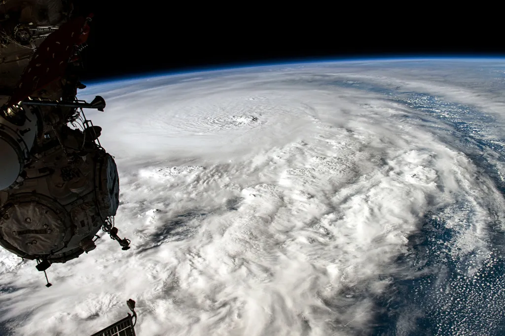
Hurricane Milton hit Florida on October 9th becoming the fifth hurricane to make landfall in the U.S. this year. This storm came not too long after the previous hurricane, Hurricane Helen which caused terrible damage to many properties in Florida and North Carolina. This quick recurrence of a storm has caused meteorologists to start making forecasts faster and they have a new sidekick to help them! Even though meteorologists have made digital models of many storms with the help of satellites, buoys and planes for a long time there are some cons to this method one of these cons of this method is that these models can take hours to fully produce updated forecasts. But using AI makes it much more detailed and accurate while shortening the time needed to generate the forecast, AI can use information from previous storms which they can use to recognize patterns that most humans can’t. this is a HUGE benefit for those who are going to be affected because they can plan for resources or even leave the affected area. Matt Lanza is a meteorologist. He’s based in Houston, Texas. In the week before Hurricane Milton made landfall, Lanza says, older models accurately predicted where in Florida the storm would hit. But AI models “probably picked up on that potential outcome a good 12 to 18 hours before,” he says. Those hours can make a big difference to people preparing for a storm’s impact. The AI platform they are using is called GraphCast. This program predicted that a hurricane would hit Texas on July 8th whereas the older method predicted it to hit Mexico. The difference between the predicted areas is so far the judges called GraphCast “Revolutionary Advance!” This new technology is substantially helping the weather forecast get people more accurate news without a long time stand.
(words cited from https://www.timeforkids.com/g56/forecasting-with-ai-g5/?rl=en-900)
